
April Snowstorm Brings Nearly A Foot of Snow to SE Minnesota
Rochester, MN (KROC-AM News)- A week defined by summer-like weather was followed by weekend winter walloping for the Rochester area.

The complex storm system arrived in Rochester Sunday evening and brought measurable snow to much of southeast Minnesota before exiting the region Monday morning. The snowfall has prompted several late starts for school districts across the area.
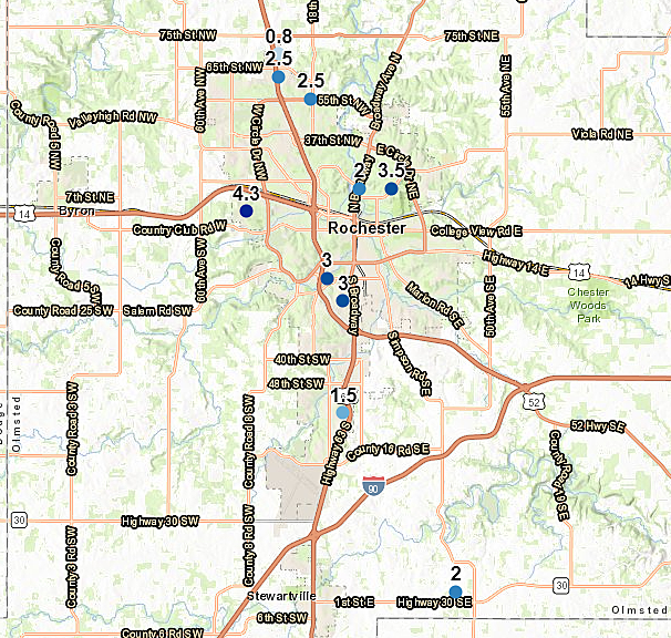
Preliminary snowfall reports submitted to the National Weather Service indicate Rochester saw between 1.5 and 4.3 inches of snow. The low end of that range was reported at the Rochester airport while the high total came in from an area near West Circle Dr.
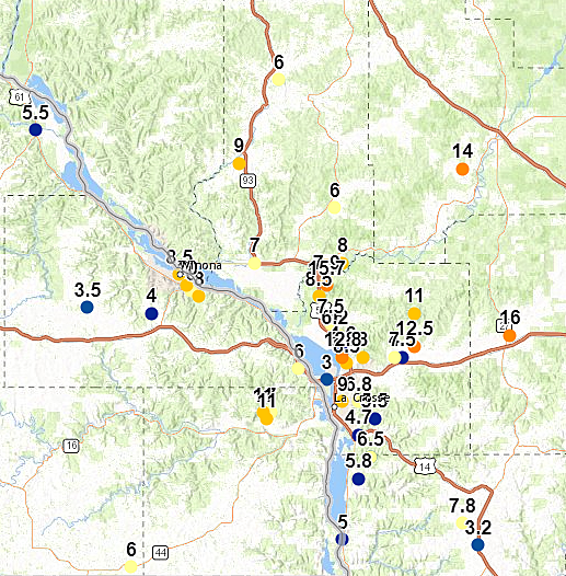
The heavier band of snow appeared to have concentrated on the Mississippi River Valley. The National Weather Service has taken a report of 10 inches of new snow in Winona, 11 inches in a rural area of northeastern Houston County. Several areas of Wisconsin’s La Crosse County reported over one foot of snowfall.
MnDOT plow crews are clearing the snow and ice from the region’s roads. For real time road conditions and the latest in weather-related announcements, visit the KROC News App.
The new snowfall is not expected to stick around. The National Weather Service forecast for this week is calling for highs ranging from the mid-40's to upper 50's, however forecasters are predicting another system to move in Friday evening that's capable of producing rain, mixed precipitation and snow.
11 of the Most Devastating Weather Disasters in Minnesota Throughout The Years
More From KROC-AM


