See the Angry Skies that Appeared Over Iowa During Sunday Storms
Mother Nature put on quite a show on Sunday. High winds, lightning, hail the size of baseballs, and heavy rain. Much of it, we could do without. But in the storm's aftermath came something strange and beautiful. Clouds so puffy and peaceful that everyone just had to rush outside and get a picture!
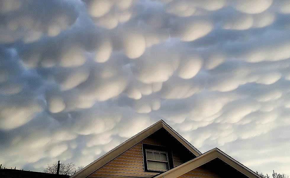
If your social media news feed is anything like mine, it is full of pictures of hail and of puffy "cotton ball" like clouds that appeared after yesterday afternoon's storms. These types of clouds are called Mammatus clouds. They are gentle downdrafts of cool air that form underneath a thunderstorm's anvil.
LearnWeather.com reports that Mammatus clouds vary in size and definition. Small storms will form smaller versions while intense storms, much like what we saw yesterday across Eastern Iowa, will often produce fields of Mammatus clouds. If you see these puffy clouds, it does NOT mean that a tornado is imminent. LearnWeather reports that there is no known correlation between Mammatus clouds and tornadoes.
LearnWeather reports that Mammatus clouds are often best seen after a thunderstorm passes by. That certainly was the case on Sunday. Long after the winds died down and the rain had stopped, these puffy clouds appeared across Eastern Iowa.
Ever See Ghoulish, Turbulent Storm Clouds Like Ones Spotted In Lavallette Yesterday?
More From KROC-AM