Potential for Accumulating Ice Prompts Winter Storm Watch for SE Minnesota
Rochester, MN (KROC-AM News)- The potential for accumulating ice in Rochester and throughout southeast Minnesota has prompted the National Weather Service to issue a Winter Storm Watch.

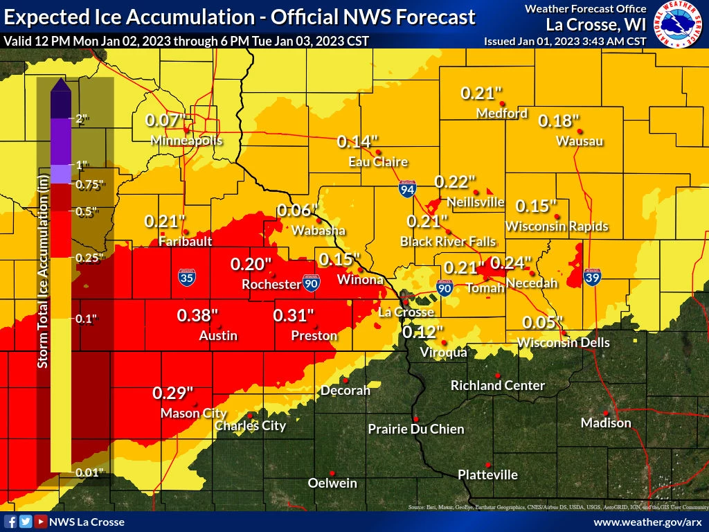
Sunday morning’s forecast calls for the winter storm to arrive in the region Monday evening. Widespread ice accumulations of 0.1-0.2 inches are predicted for the area with higher amounts of 0.3-0.4 inches possible west of the Mississippi River Monday night into Tuesday morning.
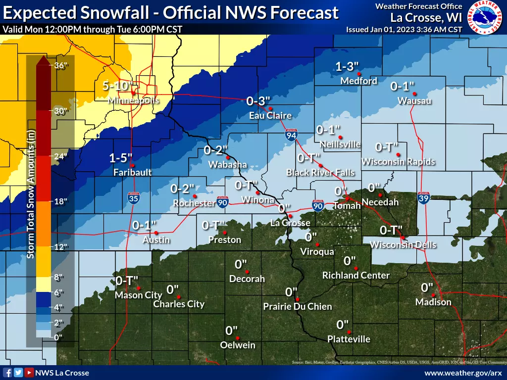
The mixed precipitation is then predicted to switch to snow by Tuesday. Rochester is predicted to get between 0-2 inches of snow with higher snowfall amounts predicted for communities north of Rochester.
Officials say the accumulating ice and possible snowfall could make travel difficult for the Tuesday morning and evening commutes. The potential ice accumulation could also cause power outages and tree damage.
Forecasters say the storm track is likely to change over the coming days which could shift the areas slated to get accumulating snow and ice. The Winter Storm Watch is scheduled to begin at 6 p.m. Monday and expire at 6 p.m. Tuesday.
KEEP READING: Get answers to 51 of the most frequently asked weather questions...
More From KROC-AM