Possible Super Cell Development Prompts Tornado Watch For Region
Update: Severe Storms Bring Tornado, Large Hail to Southeastern Minnesota
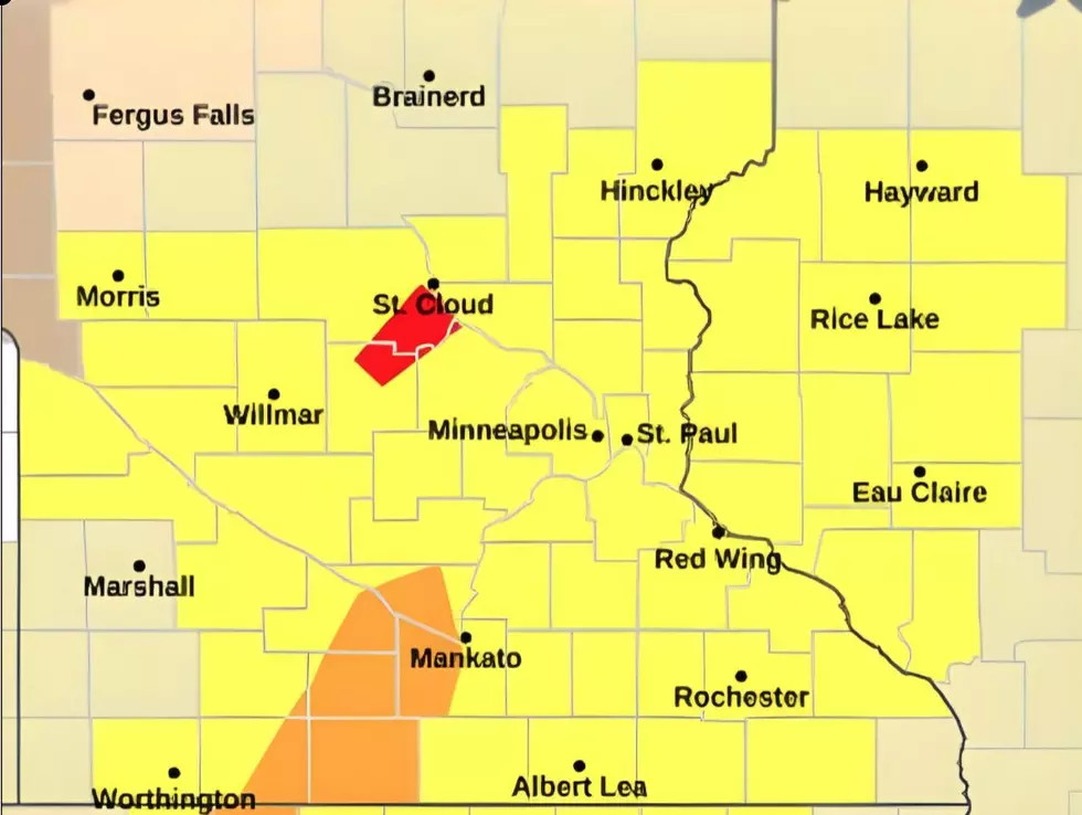
Rochester, MN (KROC-AM News) - The Rochester area and nearly all of the southern half of Minnesota are now included in a tornado watch until 11 o'clock tonight.
Severe storms are forecast to develop move across the region this evening and some could be severe. The National Weather Service says the main threat from the storms will be damaging hail and wind along with the potential for tornadoes and even long track tornadoes. On a scale of 1-5, the National Storm Center is rated the risk of severe weather in southern Minnesota at level 4.
Forecasters: Severe Storms and Possibly Tornadoes Likely This Evening
A stacked low pressure area is pulling moisture from the south into the region and forecasters say it could produce so-called super cells that are often associated with strong tornado activity and large hail. As of 4 PM, possible tornado activity was producing warnings in the St. Cloud area and a line of strong thunderstorms was marching across southwest and south-central Minnesota, where severe thunderstorm warnings were in effect.
Weather Closings and Delays in SE Minnesota - Monday, April 28th
The National Weather Service is urging everyone to pay attention to the weather this evening and tonight, and to review plans for seeking shelter in the event of severe weather.

More Minnesota News:
- Apartment Fire Leads to Arson Charges Against Rochester Man
- Truck Hauling Hogs Crashes in Dodge County - 43 Hogs Euthanized
- Lyft Driver Carjacked in Stewartville, Rochester Man Charged
20 Best Public Schools in Minnesota
Gallery Credit: Carly Ross
More From KROC-AM